


Just south of Nambucca Heads on the north coast of New South Wales, the Gumma Indigenous Protected Area (IPA), dedicated in 2011, complements the estuarine system for the adjacent Gaagal Wanggaan (South Beach) National Park on the eastern seaboard. To the west the Nambucca River separates Gumma IPA from the mainland, creating a small peninsula. Three islets float at the mouth of the Nambucca River, creating a link between the IPA and the Pacific Ocean.
The Baga Baga and Ngambaa clan of the Gumbaynggirr have been the traditional owners of the Gumma environs ever since the creation of its coastal environment 6,000 years ago. Both Gumbaynggirr creation stories and scientific evidence show that the estuarine and marine ecosystems developed during the time of the Traditional Owner’s occupation of the area.
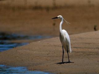
The Gumma IPA comprises a diversity of aquatic interface habitats - including shoreline, coastal dunes, sand flats, rocky shores, estuary, estuarine islands and the tidally influenced Warrell Creek on the eastern boundary.