


Situated about 35 kilometres north-east of the New England township of Guyra, Wattleridge Indigenous Protected Area (IPA) was dedicated in 2001. Covering 480 hectares of botanically diverse bushland growing on outcropping granite country, the IPA is bounded by the Sara River flowing to the north. The land’s rocky ridges and rolling landscape are separated by forested valley flats, picturesque creeks and tumbling waterfalls.
Part of the traditional lands of the Banbai community, Wattleridge IPA contains traditional camping areas, Aboriginal rock art, scarred trees, axe grinding grooves and tool making sites.
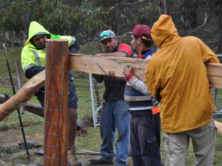
The Wattleridge Rangers manage the IPA along with the Tarriwa Kurrukun IPA in partnership with the property owners, the Banbai people. The rangers help to protect the land's wildlife habitats, educate visitors on the conservation values, run a seed nursery for revegetation of degraded areas, map and control feral animals and promote the biodiversity of the area.